
If a historic or archaeological site disappears or changes, how will we remember what it looked like and how it was built? Today, LiDAR scanning technology is being used around the world, including here in Colorado, to map and understand places at a deeper level than can be seen by the naked eye or through traditional photography alone.
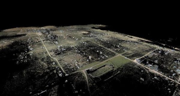
How does LiDAR work? LiDAR, which stands for “Light Detection and Ranging,” works by beaming pulses of laser light at a surface in order to take measurements and create 3D maps and models. LiDAR scanners are also frequently used in combination with other technologies, such as drones and ground-penetrating radar, to get a larger view of a site. Laser scanning is used in a number of applications including geosciences, surveying, and mapping. But it is also an extremely helpful tool for understanding archaeological and historical sites, and has been the subject of a great deal of study in the archaeology and historic preservation fields.
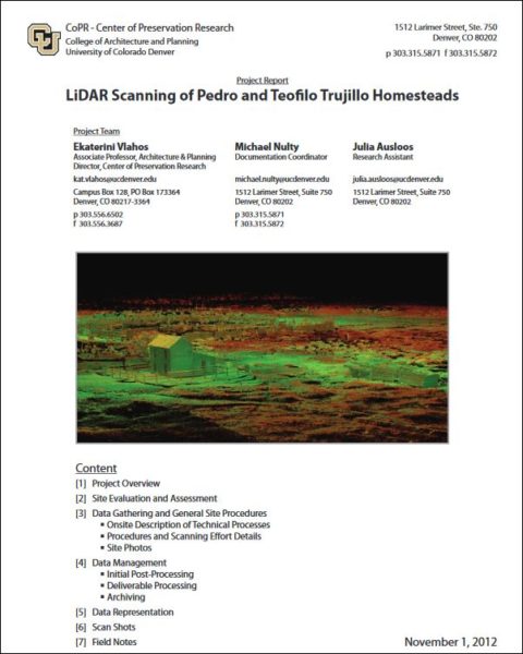 Among those studying LiDAR technology is the University of Colorado Denver’s College of Architecture and Planning. Their Center of Preservation Research has documented several sites in Colorado and the West using LiDAR technology, including the Trujillo Homestead near Alamosa; the McElmo Flume, Moose Tower, and the Canyons of the Ancients National Monument near Cortez; and Independence Rock in Wyoming. Each study has been detailed in project reports which are available online via our library. The Center’s newest project, completed this summer, uses LiDAR imaging to map the Amache Japanese American Confinement Site near Grenada in southeastern Colorado. To learn more about each project and how the results will be used to preserve these important sites, visit the Center’s website.

- How to Spot the Differences Between Eagles and Hawks - August 16, 2021
- How Transportation Projects Help Tell the Story of Colorado’s Past - August 9, 2021
- Time Machine Tuesday: The Night the Castlewood Canyon Dam Gave Way - August 3, 2021