
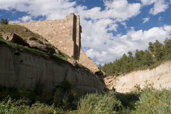
Today, Castlewood Canyon is one of Colorado’s 41 State Parks. But on this day 88 years ago, August 3, 1933, torrential rains caused the Castlewood Canyon Dam to break, leading to one of the worst floods in Denver history.
Castlewood Canyon is located near Franktown, Colorado, south of Denver in an area that in the 1930s primarily consisted of farms and dairies. The dam was constructed by the Denver Water Storage Company in 1890, holding 5,300 acre feet of water for use by area farmers. Over the years, however, the poorly constructed dam became more and more unsafe. It continued to be used for irrigation purposes, however, and within a few decades the area also became known as a scenic vacation spot — a foreshadowing of today’s State Park.
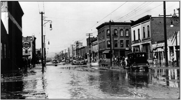
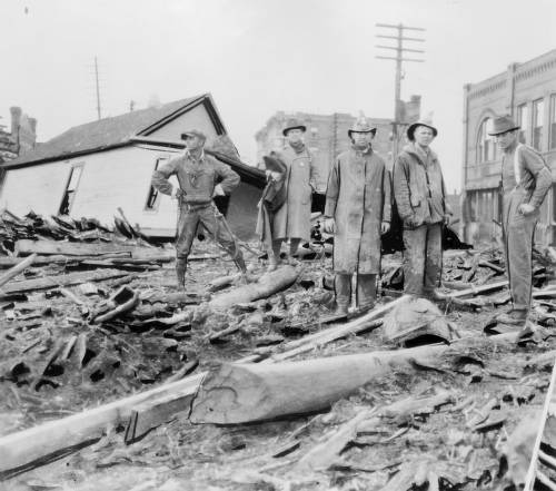
Leading up to the night of August 3, unusually heavy rains had been falling for several days. At one point, eight inches of water poured down in only three hours. It was just too much. That evening the dam burst, rushing floodwaters down Cherry Creek toward Denver. The waters saturated local farms and carried debris and uprooted trees for miles. 15-foot-high waters rushed toward downtown, first passing through southeast Denver and then culminating in the area near Speer Boulevard and Cherry Creek. The waters destroyed bridges on Colorado Boulevard and on Stout and Champa Streets. Several buildings were demolished and, sadly, two persons were killed. However, it could have been worse. Many people were warned of the floodwaters and able to get to safety thanks to the expansion of the telephone in Denver and the surrounding area. Switchboard operators worked through the night to get the word out about the flood’s path, so that many were able to get to safety.
As a result of the flood, additional flood control efforts were undertaken and eventually the Cherry Creek Dam and Reservoir were constructed. Castlewood Canyon was officially designated a State Park in 1964, when a descendant deeded his family’s homestead lands to the State Parks system. Over the next several decades the State purchased additional lands, now preserving a total of 2,303 acres, including the remnants of the dam. More background on the park can be found in the brochure Castlewood Canyon State Park: A Brief History.
In 1997 the Colorado Historical Society and Colorado State Parks teamed up on a unique project — to gather stories of eyewitnesses to the 1933 flood, which had taken place sixty-four years prior. Witnesses who mostly had been children at the time of the flood were interviewed and shared their memories, which were compiled into the booklet The Night the Dam Gave Way: A Diary of Personal Accounts. Initially printed to distribute to park visitors, the booklet is now also available in digital form from the State Publications Library. It’s a fascinating look into the lives of ordinary Coloradans who witnessed an extraordinary event.

- How to Spot the Differences Between Eagles and Hawks - August 16, 2021
- How Transportation Projects Help Tell the Story of Colorado’s Past - August 9, 2021
- Time Machine Tuesday: The Night the Castlewood Canyon Dam Gave Way - August 3, 2021