
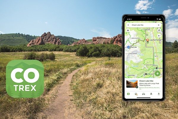
Colorado Parks & Wildlife has a free new app that “endeavors to map every trail in the state of Colorado.” Currently, about 40,000 miles of trails have been mapped. These include a variety of trails on federal, state, and local government lands. You can use the app to browse and map trails based on your interests and filter maps by various criteria. The app also includes Trip Reports and Field Notes features that allow you to add photos and make observations on trail conditions, wildlife, points of interest, and more. Users can also download trail maps ahead of time for use offline, in case there’s no cell service on the trail. Download the app on the Colorado Parks & Wildlife website. Additionally, you can learn about the app’s GIS layers and more at the Colorado Information Marketplace.

- How to Spot the Differences Between Eagles and Hawks - August 16, 2021
- How Transportation Projects Help Tell the Story of Colorado’s Past - August 9, 2021
- Time Machine Tuesday: The Night the Castlewood Canyon Dam Gave Way - August 3, 2021